
Cliff Drive
- Jun 30, 2018
- 2 min read
Updated: Sep 15, 2022

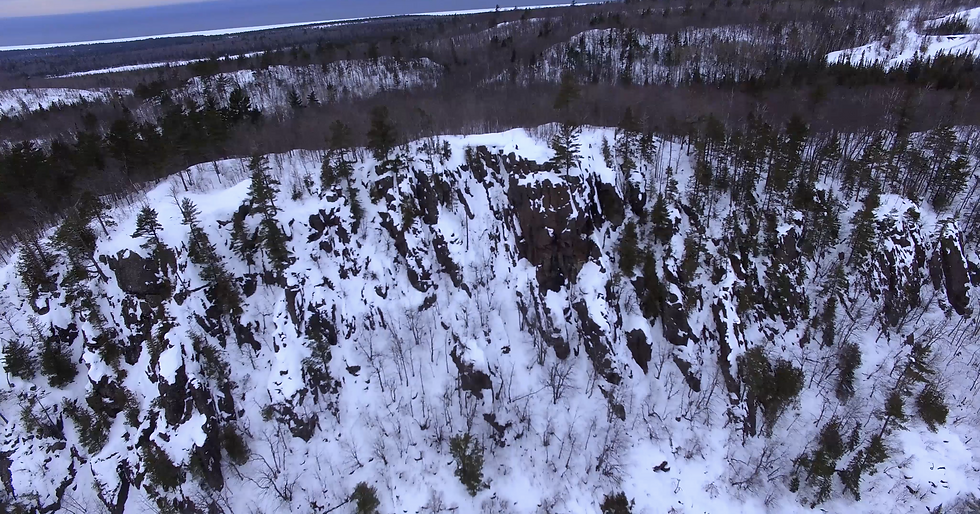
One of the better views in the Keweenaw belongs to the Cliff Range. Aptly named, this range of conglomerate cliffs stretches the length of the peninsula, though it is most pronounced at this point. As with much of the area, it too was mined in the mid to late 1800's by the Cliff Mine. Remnants of its waste rock can still be seen along with a few structures that survive to this day.
Some such structures can be seen if you look carefully through the woods about 1000 feet into the hike up the trail to your right. I'd been here countless times before but only noticed the smokestack and ruins during a winter hike after all the leaves no longer concealed them. Additional investigation revealed a shallow exploration adit that went about 30 feet into the side of the cliff. The entrance appears to have been filled in but somebody dug it back out. It's worth checking out and if you look hard enough, you can find copper in the rock walls of the tunnel.
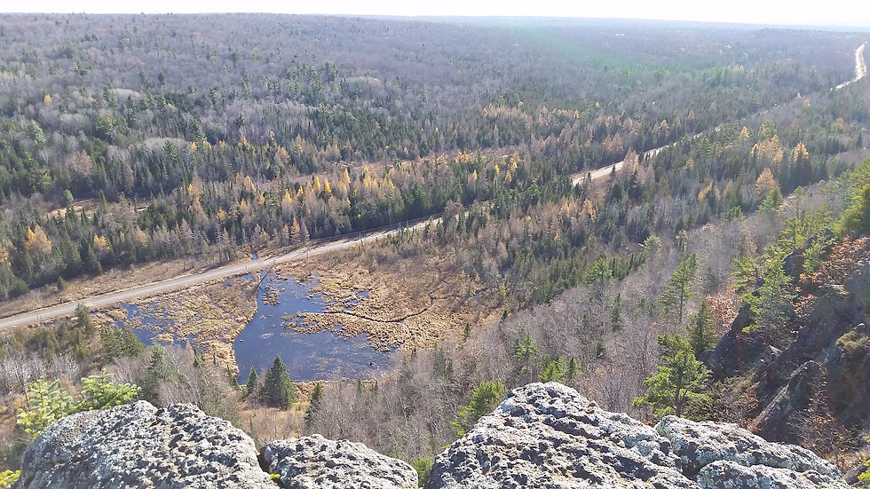
Up at the top are several great lookout points and a few flat spots that you can pitch a tent on. In good weather this is a great place to stay. Keep in mind though that there is no water though. Also on a windy day your tent will blow off the cliff unless you put rocks in it. Stakes won't do here. Also if you're into rock climbing, a lot of people do it here. They call the face "Obsession" I believe.
If you walk the trails to the northeast you'll eventually come to a mine tailings pile. I've seen people get really nice pieces of copper out of here with a little digging. Also towards the top of the tailings pile is a haunted tree with a bunch of postcards and pictures and letters nailed to it. I never took a picture but I swear it's creepy as hell.
To get here, head north on US-41 until you get to the town of Ahmeek. Right before the BP gas station is a left turn that will take you onto Cliff Drive. Drive 5.7 miles and you'll see a two track logging road that heads into the woods to your left. If you have a smaller car, park here and start hiking. Otherwise you can almost drive to the top. Follow this logging trail until you get to the first intersection. Turn right. At the next intersection, keep right. Park at the third intersection if you've been driving. walk down the right road about 30 feet and you'll see a much narrower two track heading uphill. Take that for a little while until you see another road switchback to your right. Head up there. Take the next trail to the left and... Congratulations! You made it! You're brave for using these vague verbal directions to get this far.
For the climbers:
https://www.mountainproject.com/area/106486988/cliff-dr-keweenaw-county
Thanks to Max Pletcher for providing the pictures and Jon Clark for the drone shot!


Comments